Hurricanes
What is a hurricane?
 Hurricanes are large rotating tropical storms with winds in excess of 119 kilometers per hour (74 mph). They usually form between June 1 and November 30 in the Atlantic Ocean but can develop in other oceans as well. They are known as typhoons inthe western Pacific and cyclones in the Indian Ocean.
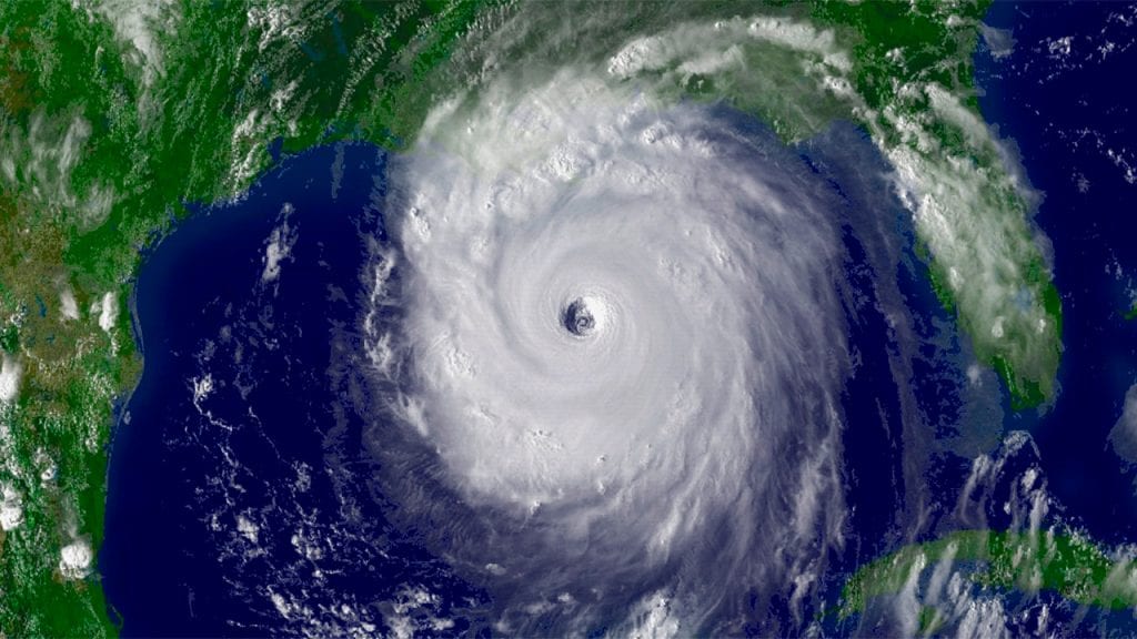
The anatomy of a hurricane is simple. Its center is a cloud-free, relatively calm area called the eye. The eye is surrounded by the much more active eye wall, a ring of thunderstorms where the hurricane’s winds are the strongest and rains are the heaviest. Spiral bands of clouds, rain, and more thunderstorms extend out from the eye wall like a pinwheel on top of a rotating funnel. These rain bands, as they’re known, can stretch for hundreds of miles and sometimes contain tornadoes.
Scientists classify the strength of a hurricane using a system developed in the 1970s called the Saffir-Simpson Scale. It consists of five categories, based on wind strength: 1 is the weakest and 5 is strongest, with winds exceeding 251 kilometers per hour (156 mph).
How do hurricanes form?
The exact combination of conditions needed for hurricanes to form is still poorly understood, but one key factor is well documented: warm ocean water. Warm water induces evaporation, causing more water vapor to rise from the ocean surface into the atmosphere. Hurricanes begin over the ocean as tropical storms triggered by a disturbance in the atmosphere. Once triggered, the Earth’s rotation causes the warm, moist air at the ocean surface to rise in a spiral pattern. Below this rising air mass, an area of low pressure forms. As moist air rises, it releases heat, cools down, and condenses into windy bands of clouds and thunderstorms. The low-pressure base acts like a vacuum that sucks more warm, moist air into the spiral.
For a storm to gain enough energy to developinto a hurricane, the temperature of surface waters needs to rise above 26⁰ C (79⁰ F). The warmer the water, the more energy to fuel the hurricane, and the stronger it becomes. Energy released as the air rises and condenses sustains the hurricane as it moves over the ocean. Once a hurricane makes landfall its energy decreases and the hurricane weakens.
How well can we forecast hurricanes?
Like any weather phenomenon, hurricanes can be difficult to forecast. Right now, scientists can do a much better job of predicting the track of a hurricane than of estimating how strong the hurricane will be when it reaches the coast.
NOAA’s National Hurricane Center (NHC) has been responsible for hurricane prediction since the early 1950s. Once a tropical storm forms over the ocean, NHC tracks it closely, and together with partner organizations, they issue regularly updated forecasts about whether it will develop into a hurricane and where and when it will make landfall. The predicted path of a hurricane is called the “cone of certainty.” It is developed using computer models that process historical hurricane data with data on current atmospheric conditions. These forecasts extend out for about five days and are updated to reflect the dynamic nature of the storms. On average, models have accurately predicted the path of hurricanes about two-thirds of the time.
What can we learn from past hurricanes?
Scientists study evidence left by hurricanes from several hundred years ago to improve our understanding of future hurricanes. How does a scientist study a hurricane that hit in the 1400s? When a hurricane approaches a coastline, it tends to whip up sandy seafloor sediments and organic debris and fling them into nearby coastal areas where they get buried over time. Scientists can unearth this ancient submerged evidence with long, metal, straw-like tubes that extract cores from the bottom of coastal ponds or lagoons, salt marshes, or blue holes in the open ocean. They analyze the cores to help determine the frequency and severity of long-ago storms, understand the factors that generated past hurricanes, and help predict future hurricane patterns.